How to use the pen tool to draw houses

Following the previous tutorial about town design here’s a tutorial on filling in the buildings in the town.

I’m jumping in at the stage where we’ve already got the terrain, major locations and roads mapped out. The next step is filling all the remaining space with buildings to turn a skeleton of a town into a town. The key here is to give the impression of a large number of buildings, without having to agonise over every single chimney pot and awning. Continue reading “How to use the pen tool to draw houses”

The West

Map of the West for George RR Martin's series A Song of Ice and Fire, detailing Westeros, the Summer Isles, the free cities and the Narrow Sea
The West, © George RR Martin 2012, used with permission

The map folio contains 3 vertical maps that together cover the whole world. We’ve already seen the map of Central Essos. This map picks up the west of the Rhoyne. and details Westeros, The Summer Isles and the Free Cities. Continue reading “The West”

Slaver’s Bay

Today, the cities of the Slavers. If you’re following the TV series then you might be wondering why this part of the world merits a map all to itself, but all will become clear….

Official Slaver's Bay map for Game of Thrones
Slaver’s Bay, © George RR Martin 2012, used with permission

This is the second map with detail illustrations of the different cities. Continue reading “Slaver’s Bay”

Beyond the Wall

I was wondering which map to post next, and then the weather made the decision for me. I can hardly see downtown Manhattan any more due to the snow outside my window. Winter has definitely come – in early March.

Beyond the Wall, © George RR Martin, used with permission

Continue reading “Beyond the Wall”

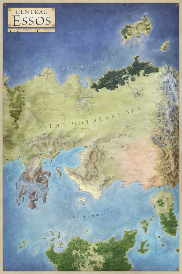
Central Essos

Today we travel to Central Essos – in the heart of the known world.

Central Essos map for Game of Thrones
Central Essos, © George RR Martin, 2012, used with permission

A Song of Ice and Fire feels evenly split to me between the the action in Westeros and the ongoing adventures of Daenarys Targaryen in central Essos.

Continue reading “Central Essos”

How to Design a Town Map

Today a quick mini-tutorial. This isn’t a photoshop tutorial, nor is it a tutorial for a polished finished map. This is a step by step in my own town creation method when I’m creating the first sketch layout. The key here is to have the town layout make sense.

Continue reading “How to Design a Town Map”

The Free Cities

The Free Cities map for Game of Thrones
The Free Cities, © George RR Martin, used with permission

Today we’re travelling to the Narrow Sea and visiting the city states of Lys, Pentos, Myr and Braavos.

Continue reading “The Free Cities”

Official World Map of A Song of Ice and Fire

Here’s the first official world map of Game of Thrones, which I was commissioned to illustrated for the Lands of Ice and Fire poster set for Random House. The Song of Ice and Fire is an epic series, and it was a privilege to create the map of the known world for the first time.

It was a dream commission for me. I originally read the books in college and, like so many others, was absorbed by the rich world. The lack of good maps bothered me, but I assumed that some day they would be created. I never expected I’d be the one to do it.

The Official World map for Game of Thrones
The Known World from Westeros to far Asshai, © George RR Martin, 2012 used with permission.

Continue reading “Official World Map of A Song of Ice and Fire”